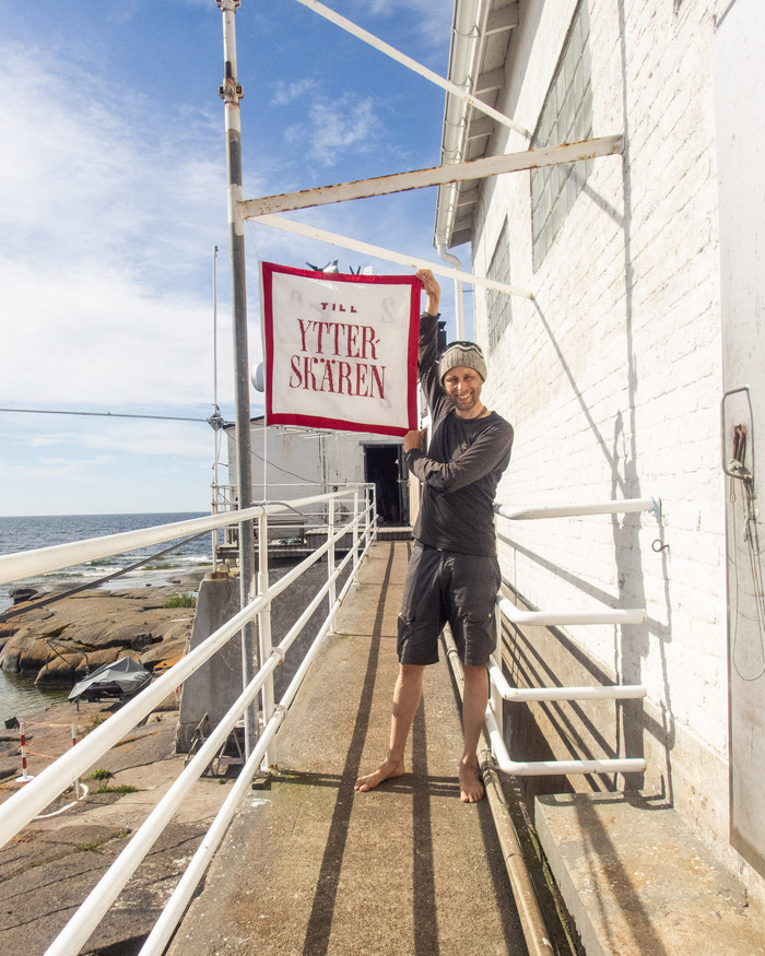
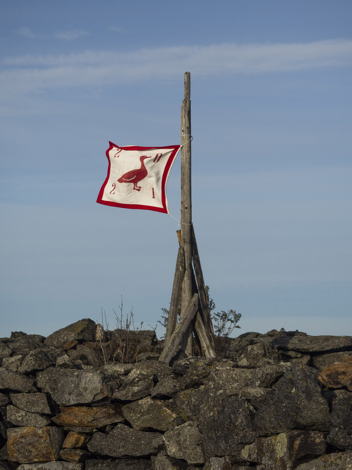
“Till Ytterskären” flag
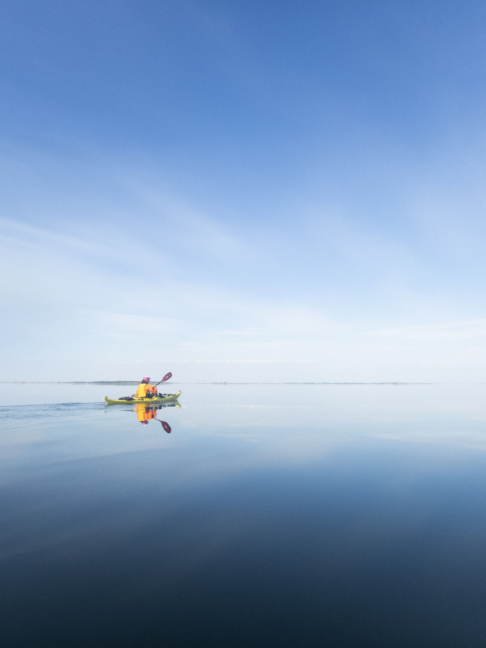
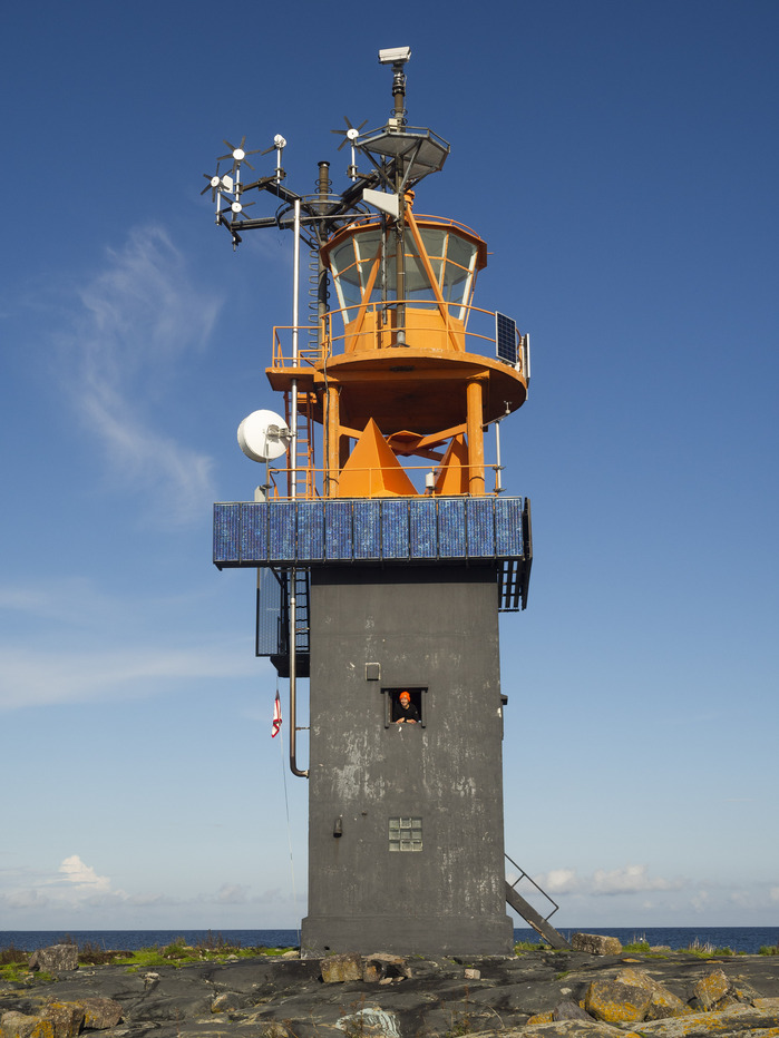
The good news? Well, at least navigating is easy. For a good amount of time the only thing on the horizon has been a tiny dot that has to be the lighthouse we’re headed towards. Other than that it’s just water. Lots of water. All around us.
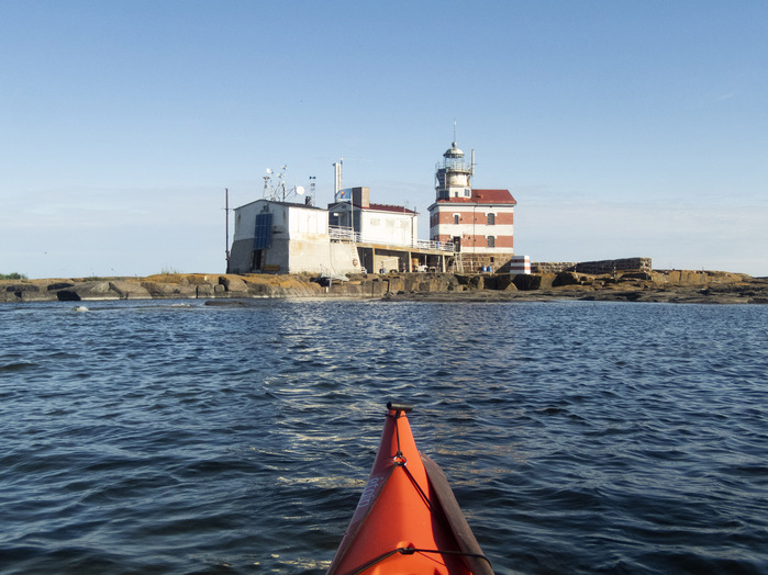
The bad news, then? Well, Kaisa isn’t feeling well. Her seasickness has increased in direct proportion to the intensity of the swells. Right now her color is closer to that of the sea underneath us than would be desirable. Taking to land at the last outpost Yttre Borgen proved impossible as the waves along the rocky shoreline would permit nothing of the sort. Now it’s been more than an hour since we made the decision to continue, and there’s no relief in sight for Kaisa before we reach small lighthouse on Märket.
According to our calculations it would take us two hours to paddle to that desolate island from the last outpost. Right now those calculations start to feel overly optimistic. The fact that Kaisa isn’t feeling well is clearly slowing us down.
Under normal circumstances this wouldn’t worry me, but right now our window of calm winds is rapidly closing. Other than my concerns about the wind the weather is close to perfect. The sky is clear and and now at nine PM the evening air is warm without being oppressively so. I try to discern if the wind is growing in its strength, but my deliberations are broken by some strange noises behind me. As I turn around I see Kaisa throwing up on the front deck of her kayak. This is not good.
However, every tragedy tends to have a silver lining, and after Kaisa has paid her dues to Neptune she begins to feel remarkably better. Our speed increases to its normal rate and soon we are able to perceive more and more details in the architecture ahead of us. We’re getting closer.
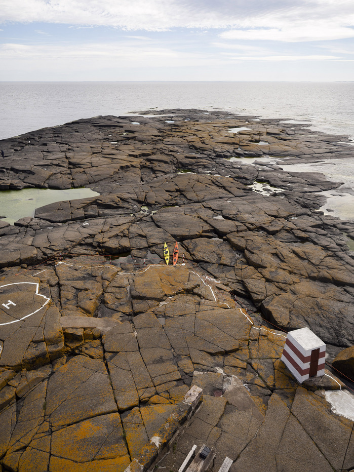
An hour later we’re standing on firm ground. It’s not a big island by any stretch of the imagination, measuring some 300 meters at its longest and a 100 meters at its widest. The island is also remarkably flat, with the highest point excluding buildings and other man-made constructions no more than three meters above sea level. But in this particular case we’re not interested in any of these geographic features, we’re just extraordinarily exhilarated to have something solid underneath our feet.
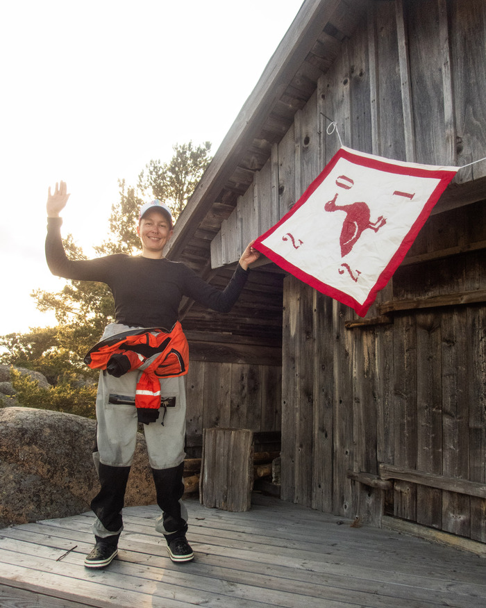
The next day we hoist our small flag on the side of the lighthouse. Seeing it sway in the gale wind makes us feel proud – we have achieved something few have. (Incidentally, the same day a taxi boat carrying tourists arrives at the shore of the island, but due to the heavy sea has to turn around after several tries. It fails in doing what two fledgling paddlers had been able to pull off. Only the knowledge that we still have to make it back to the mainland once the storm had set kept our smugness at bay.)
But back to the flag. We felt that out here on this strange little island was exactly where our flag belonged.
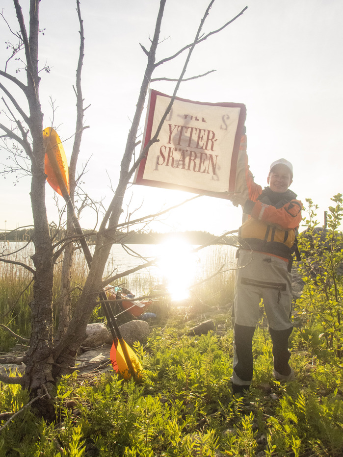
The text on the flag reads “Till Ytterskären”, which roughly translated would read “To the Outermost Islands”. I say roughly translated intentionally, as in Swedish there are more than fifteen different words describing various types of islands, whereas in English, at least to the best of my knowledge, has far fewer. Sorry, English, you lose this one!
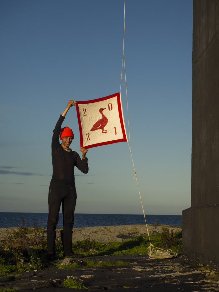
But most of you are here for type-related content, so I’ll now share with you the details regarding the design of the flag. The main two lines are set in Ambroise Francois drawn by Jean François Porchez, with the “Till” set in Diversa Sans by Dino dos Santos and Pedro Leal. On the Duck side of the flag we have the numbers 2018, and those are set in Narrow Roman Stencil JNL by Jeff Levine.
But now I feel we should return to the island. The reason I chose to call the island strange a bit earlier has partially to do with the topographical features I already wrote about. But it gets much stranger than that. You’re in for both a history lesson as well as a geography one. For the island Märket not only lies right in-between Finland and Sweden, it also belongs to both countries. Divided half and half, in a sense.
And when I say divided, you might picture a border running right across. That’s where you’d be wrong. Märket hosts one of the most peculiar borders on this planet, as it runs like a ribbon tied into a bow, seemingly all over this insignificant rock in the middle of the sea. The reasons for the strange form of the border are historical – back when Finland still belonged to Russia, a lighthouse was built here. Now as we know unfortunately all too well the Russians have not always viewed borders as something changeless, and thus the lighthouse was constructed on what was then the Swedish side. When the borderline was revised later it was agreed that Sweden should receive an equal share of island as the one Finland had now occupied.
Thus if one wants to take a small swim after enjoying a sauna (of course there is a sauna in a Finnish lighthouse!) then one inevitably crosses over from Finland to Sweden, and once more back to Finland before reaching the water. All in the span of less than a 100 meters. But the form of the border is not the end of the peculiarity – this border is also the longest land border between Finland and Sweden. Two countries that share a total border of some 545 kilometers. Now there’s something to ponder on those long nights you lay awake in bed!
Our “Till Ytterskären” flag accompanied us to four more lighthouses that summer, each journey worthy its own entry. I’ve included a couple of photographs from those trips as well, but for the stories you should head over to our homepage.
Formats
- Signs (1816)
Designers/Agencies
- Christoffer Leka (11)
- Anna-Leena Kirves (3)
Tagged with
- flags (164)
- self-initiated projects (342)
- Swedish (language) (142)
- kayaks (3)
- boats (42)
- sea (48)
- travel (115)
- adventure (17)
- islands (17)
- lighthouses (11)
- borders (politics) (6)
- red (716)
- all caps (5975)
- typeface combinations (3133)
- ducks (13)
- numerals (905)
- stencil (383)
- compact diacritics (100)
Artwork location
- Finland (155)

